Re-Thinking the Role of "Big Data" For Arctic Fire Science & Policy
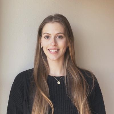
Dr. Jessica McCarty (Miami University) demonstrates how accessible data can transform our understanding of fire dynamics and fire's role in the Arctic.
Date: 3/1/22
Location: Zoom & SEEC 372 A/B
Speaker: Jessica McCarty
Abstract: Many global fire emissions models, official governmental inventories, and fire management and policy responses rely on “big” Earth observation datasets, from coarse-resolution active fire to commercial very-high resolution assessments of fuel loadings and post-fire recovery. Often, in-situ field data are treated as “the truth” when setting the standard for fire activity and also impact of fires on ecosystems, air quality, and carbon emissions. This is the case for current assessments and management of fires in High Northern Latitudes, complicated by increasing Arctic fires in the last two decades. In a place as large as the Pan-Arctic, in-situ verification of fire will be impractical if not impossible in terms of time, cost, and accessibility. Because the Arctic is both a globally important ecosystem for climate controls and a politically contested space, getting the role of big data right - from data standards, uncertainties and validation protocols, and concepts of FAIR and CARE data principles, to understanding mismatch between ground statistics and satellite imagery – is paramount. In this talk and active discussion, our goal is to think past current limitations and envision concrete ways that the Earth data science community can serve the various needs, benefits, and ethical considerations for current and future Arctic fire mapping, monitoring, modeling, and policymaking.
Bio: Dr. McCarty has a Ph.D. in Geography from the University of Maryland at College Park. She has more than 15 years of research experience in remote sensing, GIS, and geospatial with applications in wildland and prescribed fire, open agricultural burning, agricultural and food security, land use/land cover change, air quality and climate, and natural resources. At Miami University, she teaches geospatial technology, coding, spatial statistics and analytics, natural resources, biogeography and field courses, and introduction to geography as well as serving as Director of the Geospatial Analysis Center (GAC). She serves as a technical expert for the United Nations Environmental Programme’s Climate & Clean Air Coalition and a U.S. contributor to the Arctic Council’s Arctic Monitoring and Assessment Programme Working Group.

