Seeing Like a Satellite, Knowing Like a Pastoralist: Epistemic Justice and Collaboration in East African Rangelands
EDS Seminar Speaker Series. Esmee Mulder discusses different ways of seeing rangelands from remote sensing to indigenous knowledge
Abstract: In this talk, Esmee Mulder explores the tensions between scientific technologies and indigenous knowledge in rangeland restoration and conservation programs across East Africa. Focusing on Maasai territories, she critically examines how remote sensing often dominates assessments of rangeland health, sidelining pastoralist ways of knowing. Through case studies and community insights, the presentation highlights the epistemic injustices embedded in current carbon credit and restoration initiatives, and advocates for more equitable, collaborative approaches. Join us to rethink what it means to “see” the land—and whose vision shapes its future.
Bio: Esmée Mulder is a PhD researcher in Geography at CU Boulder, with a background in geospatial analysis, environmental science, and critical development studies. Her work bridges remote sensing and indigenous knowledge to support equitable rangeland restoration in East Africa. As GRA at Earth Lab, she collaborates with the NC RISCC team on monitoring and predicting ecosystem transitions. In addition to her academic work, Esmée is a practitioner, co-designing and assessing land and water management projects with local communities and diverse stakeholders particularly in East Africa.
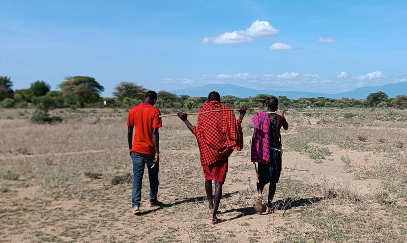
Figure 1 Maasai herders in Southern Kenya sharing about the health of their rangelands (Photo credits: Esmee Mulder)
“Quick and dirty” approaches are often used in rangeland health intervention programs across East Africa to determine which areas are degraded. Although environmental data scientists have advanced many of these methodologies, a lack of time, funding, or technical capacity often leads NGO or government officers to rely on overly simple “before-and-after” image comparisons (for example, comparing two to four remote sensing images using the Normalized Difference Vegetation Index). The simplistic and often erroneous conclusions drawn from this method can reinforce stereotypes of pastoralists and overlook generations of indigenous knowledge about managing rangeland health.
Maasai pastoralists in East Africa practice a wide range of strategies for managing rangelands and coexisting with wildlife. Through livestock diversification, strategic multi-generational crossbreeding, herd splitting, and most importantly, mobility, the Maasai have long navigated highly unpredictable and patchy rainfall across vast areas. Specific grazing areas are allocated across communities for dry-season and wet-season use, as well as for sick and young livestock. However, land fragmentation, displacement linked to conservation projects, and the accelerating effects of climate change now threaten both rangeland health and Maasai pastoral livelihoods.
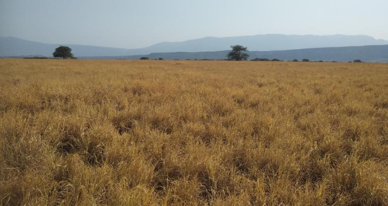
Figure 2 A dry season grazing area (Enkaron) in Southern Kenya (Photo credit: Esmee Mulder)
In response, many communities collaborate closely with civil society organizations, grassroots NGOs, and international partners to restore degraded areas. Yet, in many of these programs, “Western” scientific knowledge remains central to program design and monitoring approaches. This can lead to misinterpretations of earth observation data and to decision-making grounded in a single Western worldview, one that often separates humans and nature.
Across Tanzania and Kenya, Maasai communities have been mobilizing for epistemic justice and for greater decision-making power over how to manage the health of their traditional territories. Indigenous indicators (based on careful observations of wildlife, grasses, and livestock) can be equitably combined with environmental data science techniques such as remote sensing to co-create fairer, more inclusive monitoring and assessment tools for rangeland health.
Alongside this weaving of different knowledge systems, advanced methods in environmental data science must also become more accessible and practical for on-the-ground practitioners. In this presentation, Esmee discussed approaches to weaving knowledge systems, identifying red flags in simplistic rangeland assessment methods, and examining, through case studies, whose knowledge is centered, whose voice is missing, and how we might work together toward a more epistemically just and inclusive environmental data science.
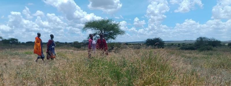
Figure 3 Maasai women managing a rangeland restoration site in Southern Kenya (Photo credits: Esmee Mulder)
Are you interested in jointly finding ways to weave knowledge systems for environmental data justice and impact? Do you have experience in advanced methodologies for assessing rangeland which you would like to make more user friendly for on-the-ground practitioners? Or are you simply excited to connect about the topics mentioned in this blog post? Feel free to reach out to Esmee - esmee.mulder@colorado.edu