How do prescribed burns provide value to people? Evaluating the ecosystem service benefits of intentional fire
Summer Graduate Research Assistant, Anna LoPresti, discusses how prescribed burns provide value to people
This Research is part of an ongoing collaboration between Anna LoPresti (GRA, Earth Lab), Jerry Gammie (GRA, Earth Lab), Cibele Amaral (Earth Lab), Nayani Ilangakoon (Earth Lab), Laura Dee (CU Boulder) & Natasha Stavros (Ball Aerospace).
Prescribed burning in the Western US
Wildfires across the Western US are becoming more frequent and severe as the climate changes, and mitigating the impacts on human and non-human communities has become a major priority across the region. At the start of 2022, the US Forest Service launched a new 10-year plan called Confronting the Wildfire Crisis: A Strategy for Protecting Communities and Improving Resilience in America’s Forests. The strategy aims to deploy fuels reduction treatments on up to 20 million acres on National Forest System lands to reduce wildfire risk in the West. Prescribed burning - the intentional application of fire to the landscape to achieve management goals - is a key component of the Forest Service’s fuel reduction strategy.
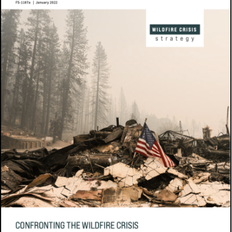
The USDA Forest Service’s 10-year strategy to confront the wildfire crisis aims to scale up prescribed burning and other fuels reduction treatments that help to mitigate the impacts of wildfire
In order to scale up fuels reduction treatments to the levels specified by the Forest Service, the benefits and tradeoffs between wildfire risk reduction and other management goals must be integrated into decision-making. Prescribed burning has been shown to effectively reduce wildfire risk and severity - however, most efforts to evaluate fuels treatment effectiveness focus exclusively on wildfire risk reduction and have not considered the impacts of prescribed burning on other management objectives such as ecosystem services: the benefits that people obtain from nature.
Ecosystem services are an important component of land management, especially for public land agencies whose mission often includes ecological, social, and cultural goals. Can prescribed burning contribute to these goals, in addition to mitigating the risks of wildfire? This is the question that our team of researchers started to explore this summer.
NASA satellites for prescribed fire research
To answer this question, we are using cutting-edge data from some of NASA’s new satellite missions. Remote sensing data collected from the International Space Station provides unique opportunities to view Earth from a new perspective and collect data at unprecedented scales. Using imagery from the ECOsystem Spaceborne Thermal Radiometer Experiment on Space Station (ECOSTRESS) and the Global Ecosystem Dynamics Investigation (GEDI) missions, we can gather information about vegetation health and biomass - two important aspects of ecosystems that can be used to understand ecosystem services.
Using ECOSTRESS, we can measure vegetation health with the Evaporative Stress Index, a measurement that tells us how drought resistant a community of plants is based on their ability to use available water. With GEDI we can measure 3D plant biomass, an important measure of the amount of carbon stored in ecosystems. Together, these two satellites help us measure important ecosystem services: drought regulation and carbon sequestration.

Remote sensing imagery captured from ECOSTRESS and GEDI provide new ways to answer questions about the impacts of fire on ecosystems at global and regional scales.
Research design
How do we use satellite imagery to understand the impacts of prescribed burning on these ecosystem services? The answer: bringing together a wide range of scientific experience. Our research team includes ecologists, computer scientists, and remote sensing experts that have co-designed a project that none of us could have achieved individually.
My role in this interdisciplinary team is to use GIS tools and spatial data to identify where prescribed burns have occurred, and the ecosystem service values in locations that have experienced prescribed burning compared to areas that haven’t. The Forest Service has a database of their fuels treatments activities over the past few decades, which can be used to map and identify prescribed burns across the US. Combining this information with the satellite imagery from ECOSTRESS and GEDI, we have the ability to evaluate ecosystem services within prescribed burns.
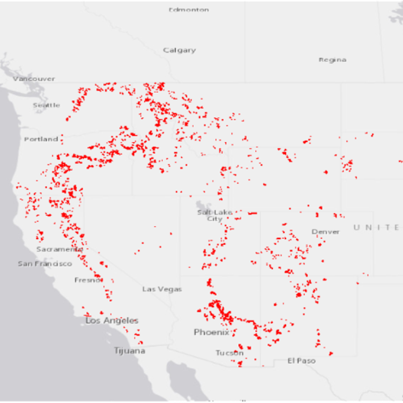
Prescribed burns have been implemented across Forest Service lands in the Western US, but scaling up treatments is an important component of the agency’s Strategy to Confront the Wildfire Crisis.
In order to determine whether ecosystem service values are different in areas that have experienced prescribed burns, we are using a statistical approach called matching: identifying points inside the prescribed burns and ‘matching’ them with points outside of the burn that are as similar as possible. By matching points based on aspects of the landscape like elevation, forest cover type, temperature, and precipitation, we are able to say that any differences in ecosystem service values between the points is due to prescribed burning instead of some other underlying difference between the two locations. This approach is especially useful for answering environmental questions without needing to set up an experiment - we can use the prescribed burns that have already been implemented to answer our research questions across the entire Western US.
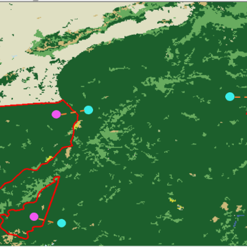
Example of statistical matching: Prescribed burns (red) contain different types of land cover classification including different types of forests and grasslands (different shades of green). We can find similar points to compare inside (pink) and outside (blue) of the prescribed burns by matching based on land cover classification.
Once we have finished putting the dataset together of matched points inside and outside of the prescribed burns, we can analyze whether prescribed burns resulted in a change in ecosystem service values for drought resistance and carbon sequestration. Answering that question is the next step in our collaborative project, which we aim to complete by the end of 2023.
Using the results from this analysis, we aim to develop an online tool that provides information about the expected changes to ecosystem services for planned prescribed burns. We will communicate with fire and fuels managers in the development of the tool, to make sure that it matches their information needs and provides a useful framework for considering the impacts of prescribed burns on multiple management goals. Confronting the wildfire crisis requires collaboration between scientists and managers, and using the tools and data we have at our disposal. That is why the application of new remote sensing data provides an exciting opportunity to improve our understanding of when, where, and how prescribed burns can provide benefits to communities.