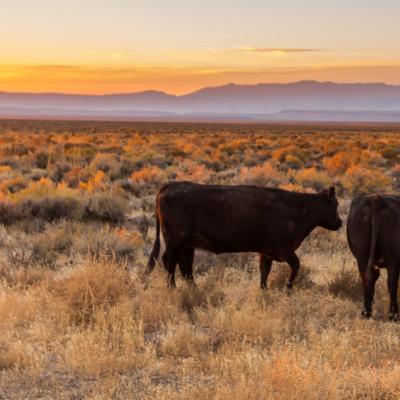
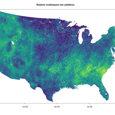
In Earth Lab, Travis leads work on environmental risk and decision-making, and developing the science and tools that can improve adaptation to a changing environment, with a recent focus on agriculture, infrastructure, insurance, and hazards mitigation, areas sensitive to the pace and pattern of environmental change.

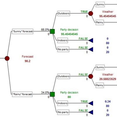
Prof. Travis studies the human dimensions of natural hazards and climate change. His current projects focus on risk and decision-analysis applied to climate adaptation in agricultural, ecosystem, and infrastructural systems. Prof. Travis teaches classes in environmental geography, natural hazards and risk analysis, and research design.  His first study of how people use weather information was published in 1979 and his first study of adaptation to climate change in natural resource systems was published in Climatic Change in 1981. Much of his early work on adaptation was based on interviews of farmers, water planners, and hazard managers. Now most of his work applies quantitative risk and decision analysis to simulate adaptation, evaluate the value of information like climate projections, and develop tools that can help resource managers adjust to a changing climate.

A changing environment offers risk and opportunity. We explore ways to use weather and climate information, from short-term weather forecasts to long-term climate projects, to make better adaptation decisions.
We work to develop a testbed of generalizable decision models that can be simulated for a range of weather and climate sensitive decision structures and contexts to calculate the economic value added in those sectors by applying climate predictions.
The Climate Coupling project seeks to measure the strength of coupling between climate drivers and social-environmental systems and to explain those measurements as a function of management interventions.
Damage from natural hazards is increasing despite the growing ability of the geo-sciences to delineate where and when extreme events will occur. We show that decades of risky development has increased exposure to the most damaging natural hazards.
Environmentally, what is extreme? What can we do to mitigate their impacts? Our research aims to answer these questions and brings an interdisciplinary, big-data perspective to risk assessment.
At Earth Lab, we often use data from diverse sources to facilitate inquiry, from the more conventional remote sensing datasets such as multispectral satellite imagery and radar backscatter, airborne lidar data, and high-resolution UAV imagery, to the less traditional datasets such as social media feeds, housing layers, and event databases.
We convened the first community organized NEON Science Summit to build community and better utilize NEON data for ecological research and education.
Travis